
 This is one of the more challanging of the popular walks in the Lake District, but is well worth the effort, taking us along the upper reaches of Great Langdale, across the head of Langstrath, past Esk Hause and finally up to Scafell Pike.
Ascent: 3,850ft
Length: 11 miles
Map: The English Lakes - South Western Area (OS Explorer Map Active) (OS Explorer Map Active)
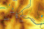
We start from the NT car park at the Old Dungeon Ghyll Hotel, at the end of the road up Great Langdale.
![]() At the end of Mickleden we reach a junction in the path. The left-hand branch is by far the bigger path, and leads up Rossett Gill - this is our path. The path up Rossett Gill is not as intimidating as it looks from the base. After following the line of the beck for some time, the path makes two big zigzags to the left, avoiding the worst sections of the original path up the Gill.
At the end of Mickleden we reach a junction in the path. The left-hand branch is by far the bigger path, and leads up Rossett Gill - this is our path. The path up Rossett Gill is not as intimidating as it looks from the base. After following the line of the beck for some time, the path makes two big zigzags to the left, avoiding the worst sections of the original path up the Gill.
![]()
![]() This climb eventually brings us to the ridge connecting Rossett Pike to Bow Fell. Our path continues across this ridge and drops down to Angle Tarn. From the tarn continue on in the same direction, following the path that climbs up towards Tongue Head, with the crags of Esk Pike to the left and the valley of Langstrath to the right. Follow this very clear path all the way to the "false" Esk Hause.
This climb eventually brings us to the ridge connecting Rossett Pike to Bow Fell. Our path continues across this ridge and drops down to Angle Tarn. From the tarn continue on in the same direction, following the path that climbs up towards Tongue Head, with the crags of Esk Pike to the left and the valley of Langstrath to the right. Follow this very clear path all the way to the "false" Esk Hause.
![]() We are now on the ridge of high ground that we will follow all the way to the summt of Scafell Pike, although we do still have two climbs to go, first onto Broad Crag and then onto Scafell Pike itself.
We are now on the ridge of high ground that we will follow all the way to the summt of Scafell Pike, although we do still have two climbs to go, first onto Broad Crag and then onto Scafell Pike itself.
This section of the walk falls into three sections.
![]() The first section takes us across the flat summit of Ill Crag. Our path onto the ridge curves around to the left, passing below a minor crag, before disappearing into a wilderness of rocks - the first of three that we will pass before reaching the summit. This first rocky patch is quite short - the line of cairns brings us up onto the Ill Crag plateau and to the start of a rock-free patch. The path then runs south west across a flat area, before curving around to the right to drop down into the gap between Ill Crag and Broad Crag.
The first section takes us across the flat summit of Ill Crag. Our path onto the ridge curves around to the left, passing below a minor crag, before disappearing into a wilderness of rocks - the first of three that we will pass before reaching the summit. This first rocky patch is quite short - the line of cairns brings us up onto the Ill Crag plateau and to the start of a rock-free patch. The path then runs south west across a flat area, before curving around to the right to drop down into the gap between Ill Crag and Broad Crag.
The second section takes us across the rocky top of Broad Crag, running just to the south of the summit. This section begins with a clear path that heads up and to the left from the bottom of the gap, before swinging to the right to head west across the top of Broad Crag. This is the worst part of the walk, across giant boulders with the route indicated by a line of crags. Just after passing below the summit of Broad Crag itself, the cairns lead us south west into the gap between Broad Crag and Scafell Pike.
![]() Once again a clear path leaves this gap, this time climbing straight up the slope ahead. The cairns then lead us south west as we climb up towards the summit of the fell, then finally turn to the right to bring us up to the summit cairn. This part of the walk is also rocky underfoot, but not to the same extent as Broad Crag.
Once again a clear path leaves this gap, this time climbing straight up the slope ahead. The cairns then lead us south west as we climb up towards the summit of the fell, then finally turn to the right to bring us up to the summit cairn. This part of the walk is also rocky underfoot, but not to the same extent as Broad Crag.
![]() In foggy weather take special care to make note of the direction you approach the summit from - the unusual shape of the cairn helps here - we approach from the eastern, curved, side of the cairn. The correct route off the top follows the line of cairns that leads east away from the summit cairn then curves around to the left to head north east towards the gap between Scafell Pike and Broad Crag.
In foggy weather take special care to make note of the direction you approach the summit from - the unusual shape of the cairn helps here - we approach from the eastern, curved, side of the cairn. The correct route off the top follows the line of cairns that leads east away from the summit cairn then curves around to the left to head north east towards the gap between Scafell Pike and Broad Crag.
![]() The only other part of the return trip that could cause confusion, especially on a foggy day, is the junction of paths at Esk Hause. Remember that there are two passes here - the genuine Esk Hause is the highest of the two, and causes no problems, as the path simply curves around to the left here to reach the lower "false" Esk Hause with it's cross-shaped stone shelter. The first time I walked this route I climbed past Esk Hause in heavy fog, and didn't realise that the path had curved around to the left at this point. On the way down in the sun I was therefore somewhat surprised to see my path heading off very clearly to the right! Remember that their are three paths here - straight ahead onto Allen Crags, left towards Sty Head, and right, towards Angle Tarn and eventually Langdale - this right-hand branch, heading downhill, is our path.
The only other part of the return trip that could cause confusion, especially on a foggy day, is the junction of paths at Esk Hause. Remember that there are two passes here - the genuine Esk Hause is the highest of the two, and causes no problems, as the path simply curves around to the left here to reach the lower "false" Esk Hause with it's cross-shaped stone shelter. The first time I walked this route I climbed past Esk Hause in heavy fog, and didn't realise that the path had curved around to the left at this point. On the way down in the sun I was therefore somewhat surprised to see my path heading off very clearly to the right! Remember that their are three paths here - straight ahead onto Allen Crags, left towards Sty Head, and right, towards Angle Tarn and eventually Langdale - this right-hand branch, heading downhill, is our path.