
 This walk takes us onto the top of Kinder Scout, one of the most famous areas in British walking and the site of the famous mass trespass.
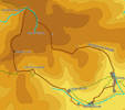
The second part of this walk crossed the Kinder Plateau. This is a most unusual area, with deep steep sided gullies cutting across a flat almost featureless plateau. Take a compass, and if it's wet on the tops turn back at the Downfall.
Ascent: 1,675ft/ 510m
Length: 9.5 miles/ 15 km
Map: Explorer 001
Last Walked:
For the purposes of this description, we start our walk from the car park on the road from Barber Booth to Upper Booth, although it could just as easily be started from Edale.
![]() At the top of Jacob's Ladder the path reaches a pass between Kinder Scout and the ridge that leads to Mam Tor. Just before reaching the top of that pass, take a path that heads off to the right, towards an overhanging tor (Swine's Back).
At the top of Jacob's Ladder the path reaches a pass between Kinder Scout and the ridge that leads to Mam Tor. Just before reaching the top of that pass, take a path that heads off to the right, towards an overhanging tor (Swine's Back).
![]() Just beyond Swine's Back the path splits. One path curves away to the right along the southern edge of the Kinder plateau. Ignore that path and follow the left hand path, heading north towards Kinder Low, the highest point on Kinder. From Kinder continue north along the path that runs along the western edge of the plateau.
Just beyond Swine's Back the path splits. One path curves away to the right along the southern edge of the Kinder plateau. Ignore that path and follow the left hand path, heading north towards Kinder Low, the highest point on Kinder. From Kinder continue north along the path that runs along the western edge of the plateau.
![]() We are now at Kinder Downfall. This is where the River Kinder drops dramatically off the plateau, at least part of the time. The size of the channel worn away by the river gives a rather more accurate picture of the normal situation here - right down the middle of the mighty channel worn into the rocks by the river in flood is a tiny groove about one inch across, and on many days the river runs down the middle of this tiny channel! Having said that, even on a dry day the downfall is an impressive feature.
We are now at Kinder Downfall. This is where the River Kinder drops dramatically off the plateau, at least part of the time. The size of the channel worn away by the river gives a rather more accurate picture of the normal situation here - right down the middle of the mighty channel worn into the rocks by the river in flood is a tiny groove about one inch across, and on many days the river runs down the middle of this tiny channel! Having said that, even on a dry day the downfall is an impressive feature.
![]() We now have to make a decision. Our preferred route on from here crosses the top of the plateau, but if the river is in flood, or the weather is foggy, or you don't have a compass, then return to step three, and take the path east along the southern edge of the plateau, rejoining our path between steps 6 and 7.
We now have to make a decision. Our preferred route on from here crosses the top of the plateau, but if the river is in flood, or the weather is foggy, or you don't have a compass, then return to step three, and take the path east along the southern edge of the plateau, rejoining our path between steps 6 and 7.
If you have chosen the route across the top of the plateau, then the start point at least is obvious. Follow the line of the River Kinder as it heads east across the plateau, before gently curving around to the right. Follow the curve through the Gates of Kinder.
After a short distance in this valley (or gully), we need to abandon the floor of the gully and clamber up onto the top of the peat. This is where that compass comes in - once you are on top of the peat, head south-east towards the edge of the plateau
A word of warning - even with a GPS, on my last visit to Kinder I strayed too far to the left, and ended up reaching the southern edge of the plateau much further east than planned, crossed Crowden Head and ended up approaching point seven from the north and not from the west as expected. Once our side valley starts to turn to the right, only a few hundred feet after we leave the main river bed, make sure that not to end up heading east. If in a gully that is twisting back to the left, clamber up onto the peat and head south east again.
![]() After a short patch on top of the peat, we should start to find a new set of gullies heading south towards the edge of the plateau. Find one that looks to have a path along its base and climb back down into the gully, and continue south.
After a short patch on top of the peat, we should start to find a new set of gullies heading south towards the edge of the plateau. Find one that looks to have a path along its base and climb back down into the gully, and continue south.
We should reach the edge of the plateau at the head of Crowden Clough, a steep sided valley heading down to Upper Booth. Here a clear path runs along the southern edge of the Kinder Plateau. Turn left onto this path, and head east around the top of the clough.
About half way along the eastern side of the clough, a second path leaves our path to the left. Turn onto this path, and follow it across a spur of the plateau to the top of Grindsbrook Clough.
Just past Edale Church the road curves to the right. At the end of that curve, just before the road turns sharply left, take the footpath that leaves the road to the right (the second pub in Edale is just to the south, and on my last visit served food quicker than just about anywhere I have been).
Follow the waymarked footpath west through the fields towards Barber Booth. Just before reaching Barbor Booth, cross over a railway bridge (at ninety degrees to the path). In Barber Booth take the first left turn to return to the main road through Edale. Once at the road we turn right, and follow the road until reaching the turn for Upper Booth. Turn right again to return to the car.