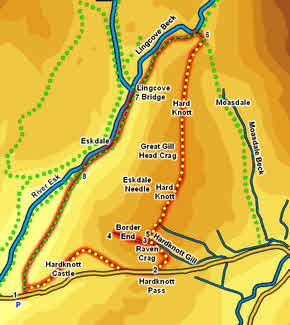
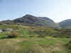
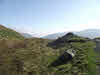
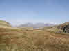
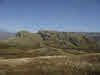
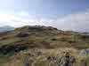
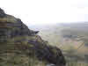
 Hundreds of people drive over Hardknott Pass on most days, but only a handful of them ever visit the top of Hard Knott fell itself. At only just over half the height of nearby Scafell Pike, Hard Knott is one of the minor players in the Eskdale scene, but its location at the head of the lower part of the valley, and the distance from other high ground means that it offers a truly spectacular view of the Scafell range and the fells ringing the head of Eskdale, as well as an impressive view down the valley towards the sea. The western summit of Border End also provides an impressive aerial view of Hardknott Roman Fort.
Ascent: 1,800ft
Length: 6 miles
Map:  Lakes South-West
Last Walked: September 2014
We start at the small car park at the western end of Hardknott Pass, just above the small bridge that takes the road over the Eskdale Hardknott Gill.
1: NY 213 011
Head uphill from the car park to the corner of the woods on the opposite side of the road. Cross the road and follow the path along the upper side of the woods to the stile. Cross the stile and then turn right onto the path that runs up to the Roman fort. Follow the path through the middle of the fort and across the parade ground beyond. The path then climbs up and curves around to the right before eventually joining the motor road over Hardknott Pass. Follow the road to the top of the pass.
2: NY 231 014
At the very top of the pass there is a large cairn. Look for a grassy path that heads off to the left of the road from the cairn, passing to the right of Raven Crag. This path gently curves around to the left, and ends up following the line of the Duddon Valley Hardknott Gill.
3: NY 229 018
The upper reaches of the gill turn into a flat bog. Follow the path along the left hand side of this until you reach a line of stepping stones that cross the bog (on a clear day the end of Scafell range will be seen ahead across the top of the fell). Remember these stepping stones, but for the moment we are going to ignore them and instead turn left onto a path that heads up onto Border End.
4: NY 226 018
5: NY 229 018
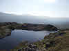
Cross the stepping stones and follow the path that runs from here to the summit of Hard Knott. First we pass another rocky summit, then a wider boggy area, with paths along the western and eastern fringes (I took the eastern path but
they come together before the summit). Follow your path up to the highest point on the fell, then continue north. The terrain is interestingly rocky until just past the large but boggy tarn marked on the map. Soon after that the rocks end and the path runs across the middle of a large patch of grassy moorland.
6: NY 235 042
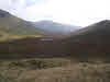
This path eventually brings us to Lingcove Beck (there are several possible paths here - mine joined the path coming out of Moasdale, turn left to follow this path to Lingcove Beck), but the key thing is to keep north until you reach the beck, then turn left onto the path that follows the beck as it runs down to Lingcove Bridge and Eskdale.
7: NY 227 036
We don't cross Lingcove Bridge - instead we take the path that continues downhill, now running alongside the
River Esk.
8: NY 219 023
There are upper and lower paths to chose from. The original junction is quite clear - take the upper path here as it brings us back to the car park without one final climb. The original junction is clear, but at there is a moment of confusion at this location, where the path crosses a stone wall. Here the clear path heads right, to join the lower path. Instead head almost straight ahead, across a rocky patch, to find the upper path on the far side. The path crosses the middle of this first field, then runs alongside the wall in the next two fields (ignore the turn down to Brotherilkeld farm in the third field). Eventually we reach the patch of woodland near the car park, cross the same stile and return to the road just above our starting point.
