
Introduction
![]() Blea Water sits in a very dramatic location, surrounded by crags on the eastern side of High Street. Crags loom around three sides of the almost circular tarn, and lower ridges run down to the mouth of the tarn, creating a closed off amphitheatre. The steep slopes drop straight down into the tarn, so there is very little level ground in the area and not much of a margin around the tarn.
Blea Water sits in a very dramatic location, surrounded by crags on the eastern side of High Street. Crags loom around three sides of the almost circular tarn, and lower ridges run down to the mouth of the tarn, creating a closed off amphitheatre. The steep slopes drop straight down into the tarn, so there is very little level ground in the area and not much of a margin around the tarn.
Blea Water is the deepest of the Lake District tarns, at 63m or 206ft. The depth has been increased by a small dam, but only by a few feet at most. The floor of the tarn drops away very quickly, and the waters are often dark and mysterious, and in shadow for large parts of the year.
To the north the tarn is overlooked by Riggendale Crag, the southern side of Riggendale, famous for its breeding Golden Eagles (although at the time of writing in 2014 there is only a single eagle).
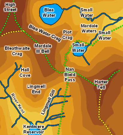
To the south the tarn is bordered by Piot Crag, the north-eastern spur of Mardale Ill Bell. Small Water sits on the opposite side of the crag, and in some ways is a smaller copy of Blea Water.
Statistics
Grid Reference of centre: NY 448 107
Altitude: 1,600ft
Map
How to Reach
A footpath leads to Small Water from the car park at Mardale Head. Take the path that runs across the end of the lake, cross Mardale Beck and follow the path that runs along the far side of the beck before turning right to follow Blea Water Beck up to the tarn.
Walks
None of our walks visit Blea Water
Inflows
A whole series of minor unnamed becks flow into Blea Water from the surrounding crags - twelve are marked on the OS map,
Outflow
Blea Water Beck flows out of the tarn, merges with Small Water Beck to form Mardale Beck which then flows into Haweswater.
Other Features
-