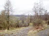
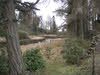
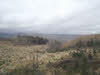
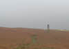
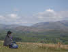
 Latterbarrow is the nearest summit to Hawkshead, and despite its limited height is a great viewpoint, with extensive views of Windermere as well as great views of the fells around Ambleside, the Langdales and Coniston fells. This is slightly longer than the normal route from Hawkshead and takes us until the woods on the western shore of Windermere before we finally reach the summit of Latterbarrow from the north-east.
Ascent: 900ft
Length: 4.5 miles
Map:  Lakes South-East
Last Walked: April 2013
We start at the pay and display car parks at the southern end of Hawkshead.
1: SD 353 980
Head out of the car park onto the main road. Turn left and follow the footpath that runs alongside the road until the road curves sharply to the left. At this point cross the road and take a footpath that heads away to the right.
2: SD 353 983
This path runs past some buildings and then crosses a footbridge. After the bridge the path turns left and runs alongside the stream for a short distance before splitting. Take the right-hand branch, which soon brings us into a wet field. Head diagonally across this field, passing over another small stream to reach a gate in a hedge line. On the far side of the hedge turn right and follow a footpath that runs around the edge of the field and then climbs up to a wall on the skyline. Cross the wall and follow the path across this field and the next one. This brings us to small lane, where we turn right to reach a minor road.
3: SD 359 985
Turn left onto the road and then sharply right onto a right of way that climbs up along the edge of Colthouse Plantation. This track curves around to the left as it climbs, crosses a stream and passes just to the left of a series of small tarns in the woods. Ignore the path that branches off to the left about a third of a mile past the tarns and follow the track as it begins to drop into the woods on Claife Heights.
4: SD 375 986
This brings us to a crossroads in the woods. Turn left here and follow this track as it curves around to the left and loses height. Ignore another trail that merges from the back-right and follow this track almost all the way to the National Trust Basecamp.
5: SD 371 994
Just before we reach the base camp a signposted permissive footpath branches off to the left (starting at a stile). Turn onto this path and follow it as it winds through the woods. This path soon regains all of the height we lost earlier and brings us to a stone wall at the edge of the open fell. Pass through this wall and follow the path as it climbs up to the summit of Latterbarrow.
6: SD 367 991
A number of paths leave the top of Latterbarrow. We can use any of the paths that run down the southern or western flanks of the fell as they all reach the same path
(the official right of way heads south, continuing on in about the same direction as our route of ascent, the other paths branch off to the right). All of these paths eventually join a path that runs alongside a stone wall at the base of the fell. Turn right onto this path and follow it down to road.
7: SD 362 991
Turn left onto the road, then right at a T-junction. Follow this lane (Loanthwaite Lane) as it passes through a band of woodland. Ignore the path in the woods and the first public right of way after the woods.
8: SD 356 990
Turn left onto the next right of way (second after the woods, close to some buildings). Follow this path through three fields to a small lane. Turn left onto this lane, then right onto a footpath. This bring us back to the hedge line we crossed back at step two. Turn right through the hedge, cross the stream, then head diagonally and to the left across the wet field. Follow the path as it heads left alongside another stream, then right over a footbridge and back to the road at Hawkshead.
