
 This is an expanded version of our ascent of Haystacks, and continues on to visit the significantly higher summits of Brandreth and Grey Knotts. Brandreth is often visited, but rarely climbed, as two major paths up Great Gable cross the flanks of the fell, but is a worthwhile target in its own right, offering fantastic views of the northern flank of Great Gable, as well as glimpses of Borrowdale.
Ascent: 2,750 ft
Length: 10 miles
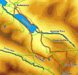
Map: The English Lakes - North Western Area (OS Explorer Map Active) (OS Explorer Map Active)
Last Walked: 11 October 2007
We start in the centre of Buttermere.
At the top of the pass we reach a crossroads. Right would take us up High Crag, straight ahead goes down into Ennerdale, and left takes us up onto Haystacks. There are two distinct scrambles on this path - in both cases the route to take is very clear, and neither are very long, but be aware that they exist. The second of these scrambles is followed by a final climb that brings us onto the fascinating summit of Haystacks.
![]() This small area is worth exploring in some detail - each side of the mountain offers different views, and there are countless tarns scattered around, not just the famous Innominate Tarn.
This small area is worth exploring in some detail - each side of the mountain offers different views, and there are countless tarns scattered around, not just the famous Innominate Tarn.
Once you have finished on Haystacks follow the main tourist path across the summit, past Innominate Tarn to Blackbeck Tarn. Just past this second tarn the path climbs up a narrow staircase between rock walls. At the top of this climb the path splits - take the right hand branch, and follow it as it heads towards the quarry.
![]() The turn for Brandreth is actually very clear. The path off Haystacks runs alongside an area of very wet ground, with the craggy northern face of Great Round How visible to the right. Eventually we reach a T-junction, where a path leaves to the right, heading to the right of Great Round How. Turn right onto this path.
The turn for Brandreth is actually very clear. The path off Haystacks runs alongside an area of very wet ground, with the craggy northern face of Great Round How visible to the right. Eventually we reach a T-junction, where a path leaves to the right, heading to the right of Great Round How. Turn right onto this path.
This path passes to the right of Great Round How and then continues across the open hillside until it reaches a fence that zigzags across the hillside, following a parish boundary across the fells. At this point the fence climbs up from our right, then just past a stile turns right, and climbs up the fell side straight to the summit of Brandreth. Cross the stile, then follow the fence (now to our left), as it climbs up the slope, heading south east. During this part of the walk we cross two major paths - Mosses Trod on its way into Wasdale, and the path up Great Gable via 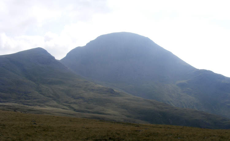 Green Gable. We reach this second path just as the fence turns away slightly to the left, and it is well worth making a diversion at this point, following the Green Gable path across the hillside to bring the northern face of Great Gable completely into view, before turning left to climb up the grassy slope towards the surprisingly rocky summit of Brandreth.
 Our route off Grey Knotts follows a clear but minor path. From our viewpoint on the left-hand summit of Grey Knotts two paths can been seen - one heads back towards the fence, and eventually leads to the top of Honister Pass. Our route runs to the left, heading just to the left of north, and picks its way down grassy slopes between the various crags that line Grey Knotts.
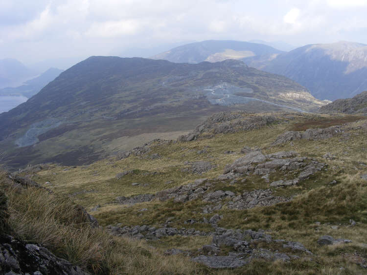
From the top of this descent our route onwards becomes very clear. To the north is the wide flat area known as Fleetwith, with the slate quarries clearly visible on the slopes of Fleetwith Pike. The popular path from Honister to Haystacks runs from right to left across Fleetwith, and coming towards us across the flat ground is an earlier part of the route to Great Gable that we crossed at step 4. Completing the picture is a minor path that cuts across the ground to the left of the Gable path to reach the Haystacks path.
Our path is clear all the way down through the crags, but then rather fades away, presumably as people have fanned out across the grass. Head for the Gable path, turn right onto it (ignore the very wet shortcut), and follow it to the path to Haystacks (marked as a Dismantled Tramway on the OS maps).