 This walk visits three very different peak district villages. We start in the large village of Baslow before visiting the estate showpiece of Edensor and the quiet village of Pilsley. The route takes advantage of the public right of way that runs through Chatsworth Park from Baslow, passing within a few hundred feet of Chatsworth House.
Ascent: 640ft/ 200m
Length: 5.5 miles/ 9km
Map: Explorer 024 White Peak District
Last Walked: 17 May 2007
We start from the car park at the eastern end of Baslow, just off the A 619 from Chesterfield.
1: SK 257 721
We start at the entrance to the car park, facing out towards the road. Turn right onto the side road that runs directly in front of the car park, and follow it as it runs east towards a bridge across the Bar Brook.
2: SK 259 721
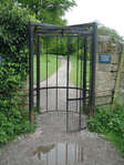
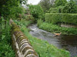
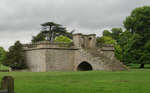
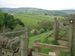
Cross over this bridge, and turn right onto a track that follows the stream. This track leads through an elaborate gate into Chatsworth Park. Once inside the park, follow the track south through the park, with the River Derwent to the right and the park itself to the left. Chatsworth House itself soon comes into sight to the left.
3: SK 257 702
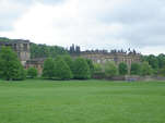
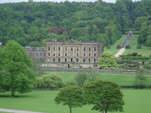 We follow this track through the park, until it reaches a bridge over the River Derwent, just level with Chatsworth House, and just past Queen Mary's Bower. This is where the main road to Chatsworth House crosses the river.
Cross over the bridge to the west bank of the Derwent. Just across the bridge, a footpath leaves the road to the right and climbs over a shoulder of the hill. Follow this path.
4: SK 251 700
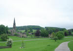
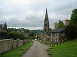
We follow this path over the hillside until it reaches the main road opposite the village of Edensor. Cross over the road, and enter this pretty estate village. Follow the main road through the village, passing to the right of the church.
5: SK 247 697
At the far end of Edensor, the road turns into a rough track, and climbs up the valley that leads west out of the village. We follow this track for the next three quarters of a mile
6: SK 235 696
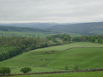
After three quarters of a mile, our track reaches a minor road (Handley Lane). Turn right onto this road, and follow it as it runs down hill along the top of a brow, with superb views to the left.
7: SK 238 706
After another three quarters of a mile, this minor road joins a bigger road at a T-junction. Cross this road, and take the footpath on the far side, continuing on in the same direction as Handley Lane. This path cuts a corner across this first field, and then joins the southern end of a farm track. Follow this track.
8: SK 238 709
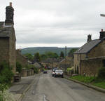
After a quarter of a mile, this track curves to the right, and then reaches a small wood, where it splits in two. Take the right hand branch, passing to the right of the trees, and head into the village of Pilsley. At the end of the village the track becomes a side road. This side road soon reaches the main road through the village, just where it turns through 90 degrees. Turn left onto the main road, and follow it as it runs down hill out of the village.
9: SK 243 712
We follow this road until we reach a footpath leaving to the left, about 600 feet past the last building in the village. This path runs along the right hand side of this first field, passing to the left of a small clump of trees. Just beyond the trees, the path crosses into the next field to the right, and drops diagonally down a grassy bank into a narrow valley.
10: SK 243 715
At the bottom of this bank, our path reaches the A 619, crosses over the road, and climbs diagonally back up the opposite side of the valley, reaching the top right corner of the first field.
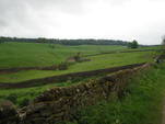
Here a stone wall continues on in the same direction as our path, with the path itself on the left hand side of the wall, running around the right hand side of the next field. The OS map shows this as being the first of a series of small fields, but in fact all three of these fields have now been merged into one. Our path follows the right hand side of this field all the way to another small road - first heading north east along the wall, then turning a little to the right, and running east, still along the wall, then finally turning to the left and heading to the road.
11: SK 244 720
 At the road turn right onto the road, and then after a very short distance turn left onto a footpath that leads into another oddly shaped field. Our path starts in the middle of the southern edge of the field, from where it heads due north across the field, before reaching the opposite wall as it dog-legs across the northern side of the field. It then turns right, and heads east, along the northern wall of the field. Although it is physically possible to cut this corner, this always runs a risk of damaging the crops, so stick to the footpath.
At the north eastern corner of this field, continue along this path as it heads east, directly back into Baslow.
12: SK 250 723
At the outskirts of Baslow, our path drops down a final slope and then reaches Bubnell Road, which runs along the western banks of the River Derwent. Directly in front of us an sizable bridge crosses the river. We cross this bridge, which leads us back onto the main road through Baslow. Turn right and follow this main road as it passes by the church. Just beyond the church we reach a roundabout. Take the left hand turn (the A 619 to Chesterfield), and follow this road back to the car park.
